Sesar Technology is system integrator for geoscience solutions in Indonesia. With a strong focus on technological innovation, we support deeper understanding of earth sciences, disaster mitigation, and the strengthening of critical infrastructure.
We offer engineering design services, software development, and advanced scientific modeling, specializing in tsunami modeling, earthquake monitoring, seismic station design and development and structural health monitoring systems.
Our team has extensive experience with SeisComP, ensuring reliable earthquake and volcano monitoring solutions, along with permanent systems designed to reduce disaster-related risks.
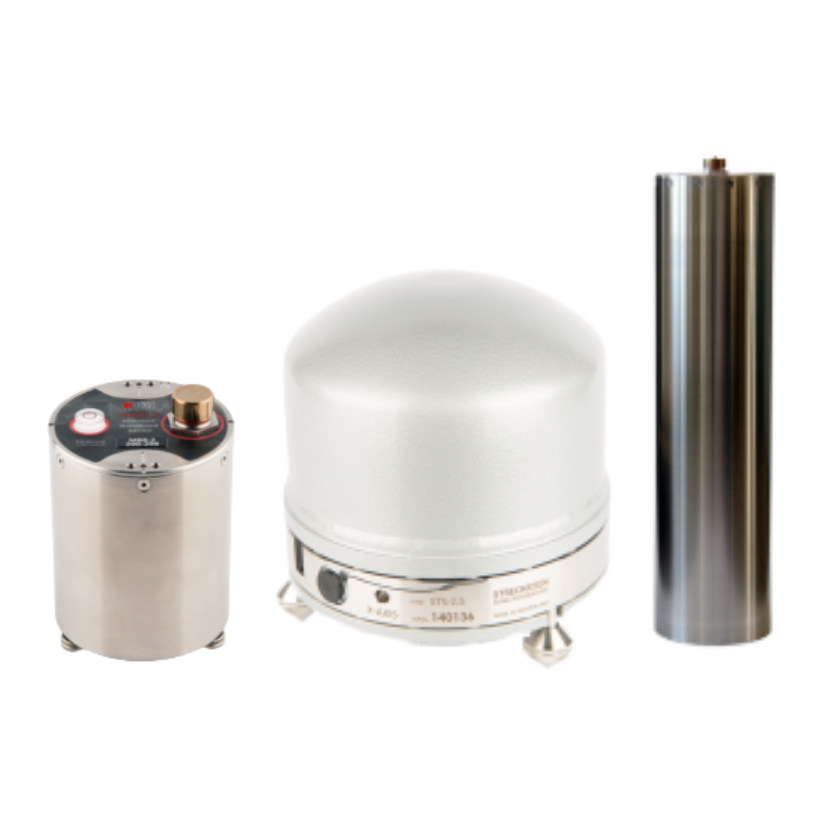
High-sensitivity broadband seismometers for precise ground-motion recording in seismic and structural monitoring applications.
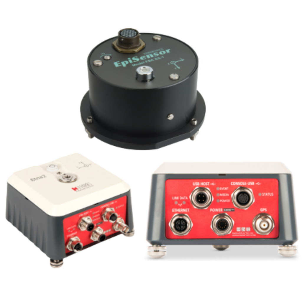
Reliable strong-motion accelerometers for accurate high-amplitude ground-motion measurement and engineering analysis.
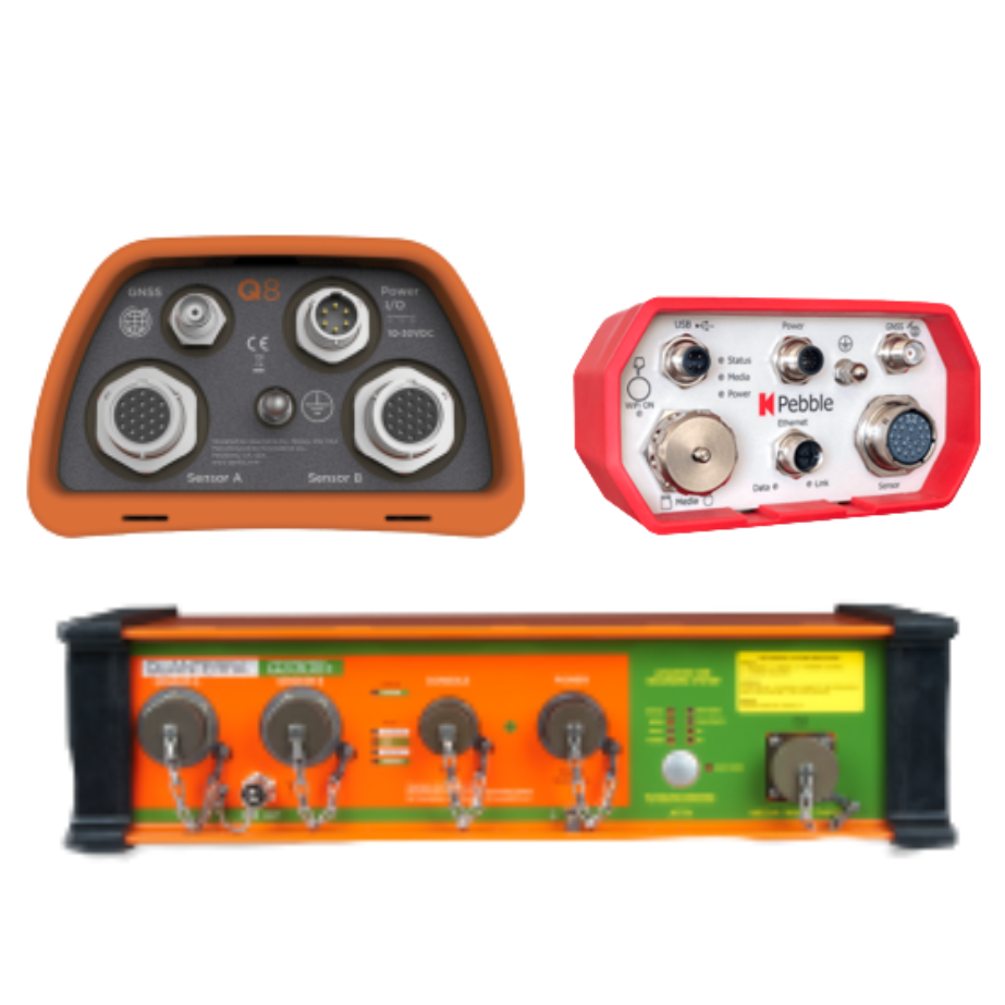
Low-noise seismic digitizers and recorders delivering accurate data acquisition and seamless integration with monitoring systems.
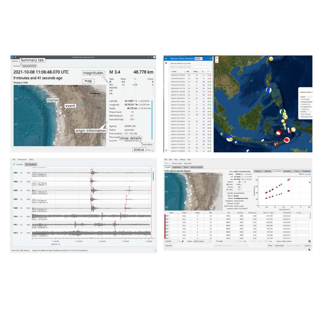
SeisComP-based software solutions for real-time earthquake monitoring, volcano monitoring, and structural health analysis.
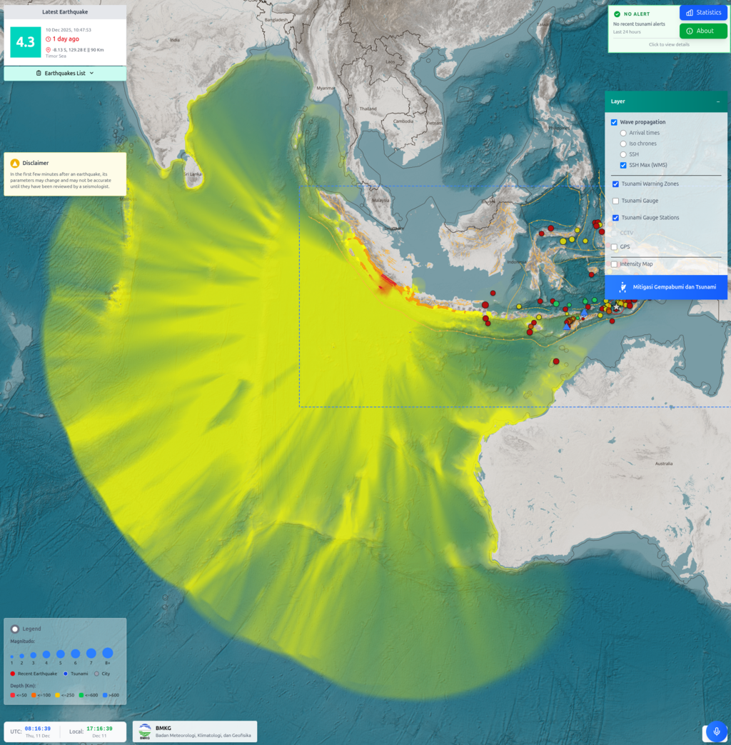
Integrated tsunami siren and AI-powered Warning Receiver System for fast, intelligent, and reliable early-warning delivery.
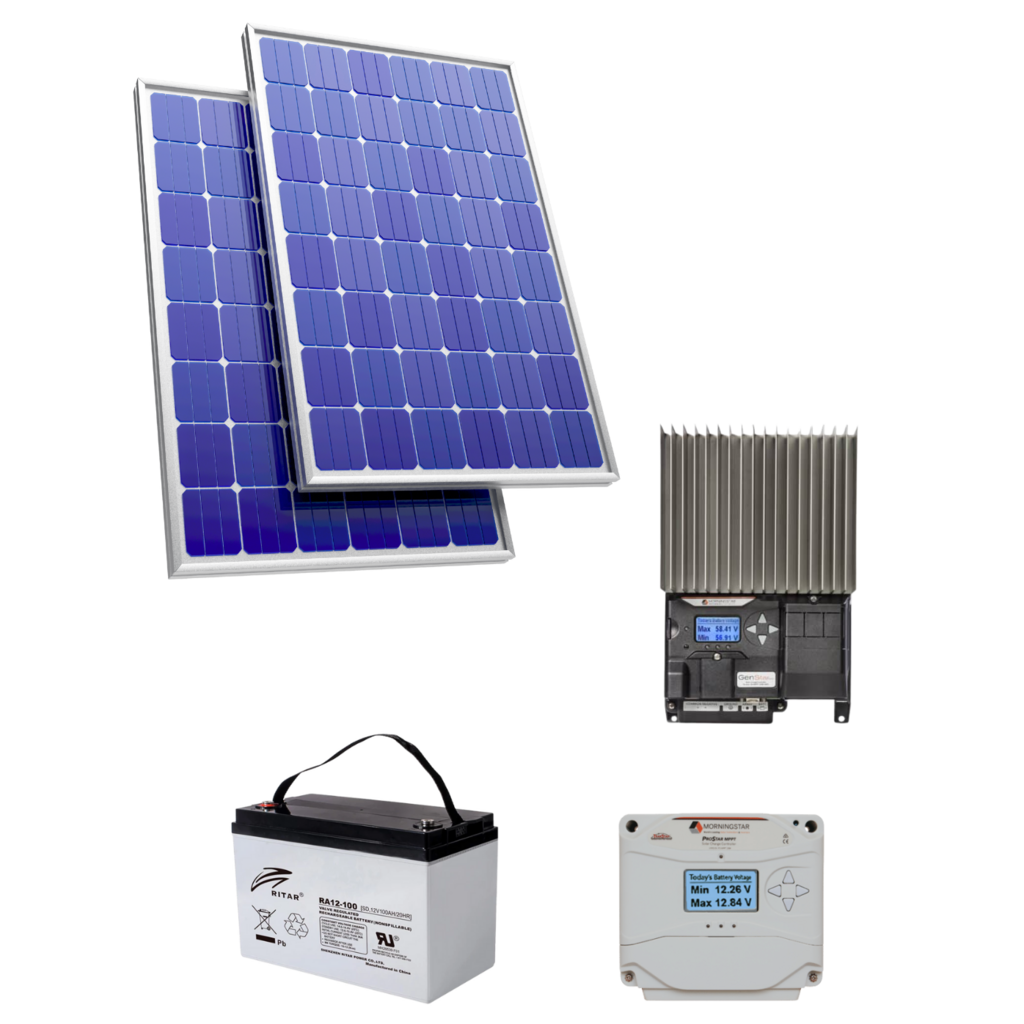
Solar-based power solutions with batteries, charge controllers, and power-management units for continuous remote-station operation.

Delivering innovative engineering design solutions for geoscience modelling and disaster-risk infrastructure, ensuring better performance and higher efficiency.

Developing specialized software to support earth-monitoring solutions and provide accurate, reliable scientific data analysis.
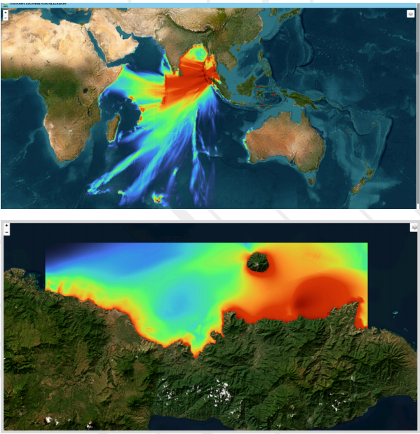
Providing advanced scientific modelling for tsunami analysis, volcanic activity, and other critical geological scenarios.
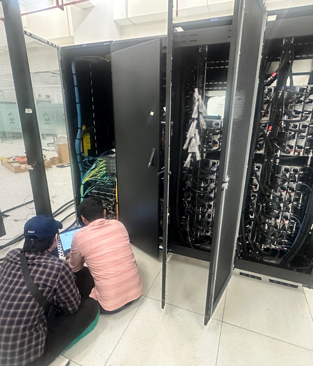
Deploying end-to-end earthquake monitoring systems, including seismic stations, processing centers, and information dissemination platforms. Ensuring every component—from sensor networks to real-time analysis—operates reliably and seamlessly to support 24/7 monitoring.
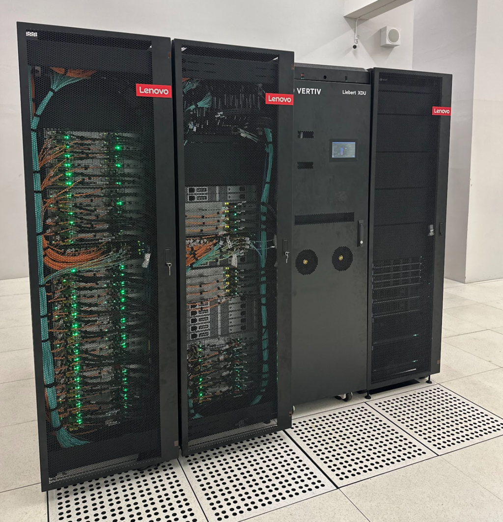
Implementing high-performance computing (HPC) environments tailored for geoscience modelling. Deploying simulation software such as TsunAWI, COMCOT, GISOLA, OpenSWPC, OpenQuake, and other scientific tools to enable large-scale, high-resolution modelling for research and operational use.

Offering integrated maintenance solutions for Earthquake Early Warning Systems (EEWS) and geohazard monitoring systems to enhance disaster-risk mitigation.
